 BOG AND BOULDER TRAIL 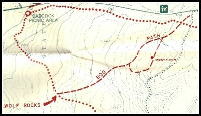 The Bog Path and Boulder Trail entrance is accessed from PA Route 56, just a two mile drive from Blueberry Meadows. This path and trail is in the Babcock Division of the Gallitzin State Forest on a relatively level plateau varying between 2,400 and 2540 feet elevation. After the virgin hemlock forest was clear cut between 1898 and 1913, sun-demanding trees invaded the area. In the 1920’s and 1930’s, uncontrolled forest fires burned and re-burned some of these areas. Subsequent heavy rains eroded the topsoil, depositing much of it into low areas to create saturated bogs that inhibited the growth of trees. In higher areas, the eroded topsoil exposed rock rubble from the last Ice Age (10,000 BCE). Both areas can be accessed from the same trail. The Bog Path circuit includes an observation tower that allows hikers to better see the large bog that was formed. 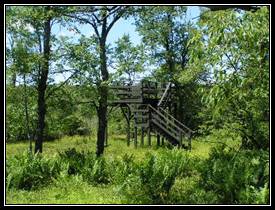 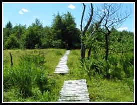 The hiking is relatively easy, however the trail is narrow and single file in most places. While the trail utilizes wooden ramps to bridge the wettest areas, a few soggy footsteps can still be expected. 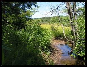 The Wolf Rocks circuit is entered after passing through the bog. It is also narrow and relatively level, but is a more challenging trail because of the many rock fields (moraines) that must be crossed with uneven footing that often puts increased pressure on the knees and ankles. 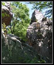 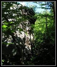 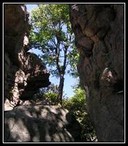 Hikers will pass through four boulder fields.The most notable of these boulder fields is the last, Wolf Rocks, an area containing boulders over fifty feet high and fissures just as deep. When returning from Wolf Rocks, hikers can take another variation of the circuit, which circumvents the bog. The entire trail can be hiked in about three hours, but hikers may want to build in some time for exploring the bog and Wolf Rocks. |